A major part of Brazil’s economy depends on a grass-fed animal—the cow. Between 1970 and 2006, Brazil doubled its cattle farm productivity, increasing income and helping with global food demands. Today, it is one of the largest cattle producers in the world. But cattle production has come with an environmental cost: the creation of pastures is a main driver for Amazon deforestation.
Researchers have recently been using NASA satellite data to monitor the spread and quality of pasturelands and to estimate how many cattle those lands can support. The recent study shows that many existing pasturelands can actually sustain more cattle.
“The main goal of our work is to produce more meat per hectare,” said Laerte Ferreira of the Federal University of Goiás (Brazil), whose work has been supported by the Gordon and Betty Moore Foundation and is part of the MapBiomas initiative. “If we can improve the use of these pastures, we can avoid more deforestation and promote livestock in a more sustainable way.”
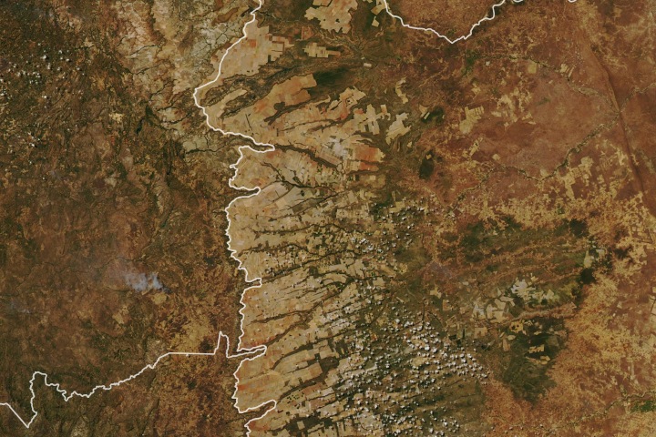
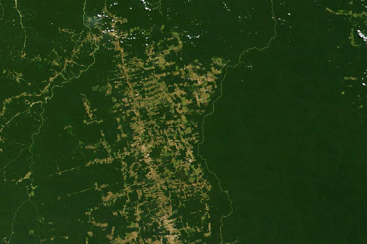
The animation above shows the expansion of Brazilian pasturelands from 1985 to 2017; it is based on an analysis of more than 200,000 Landsat images by Ferreira's group. Note how pasturelands have expanded towards the Amazon in the north. Approximately 264 million hectares (652 million acres) were mapped as pasture sometime between 1985 and 2017, which is around 31 percent of Brazilian territory. (This analysis does not account for losses of pastureland.)
As it turns out, many of these pasturelands are older or not well maintained, which leads to faster degradation. Degraded pastures tend to have bare soil, more invasive species, and less nutrients to support livestock. They also retain less carbon in the soil and contribute more to greenhouse gas emissions.
Ferreira’s team found that the northeastern and center-west portions of the country showed the most land degradation. Several other regions showed healthy pasturelands, including many that are underutilized.
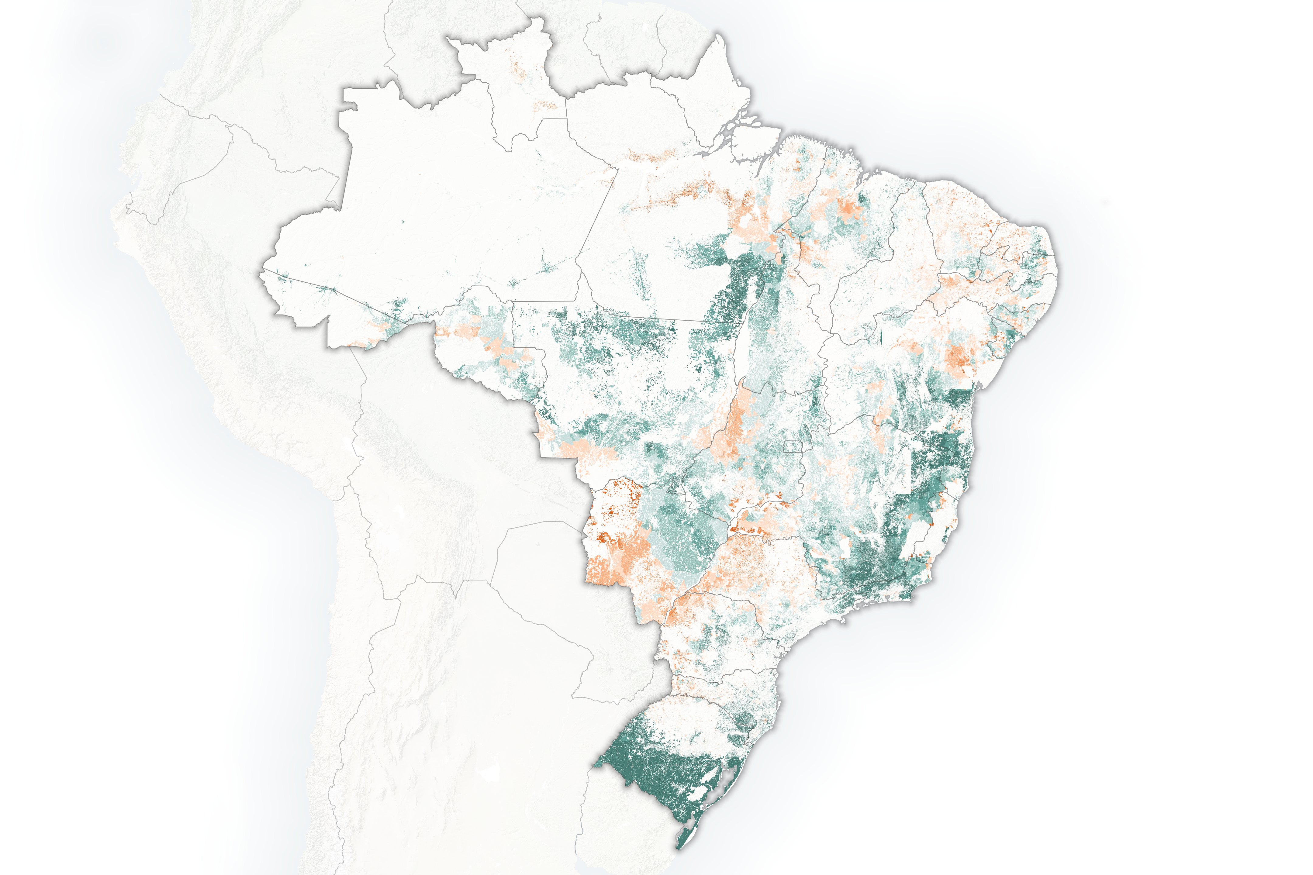
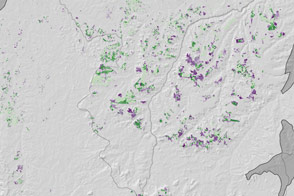
The map above highlights areas where the land can support more cattle. Most noticeably, the pastures in the Pampas region in the south can support as much as three times more cattle per hectare. (One cattle unit is estimated at 450 kilograms, or 990 pounds, per hectare.) The information was calculated by estimating the amount of cows on the land, the vegetative health of the pasturelands as observed from the Normalized Difference Vegetation Index (NDVI) and primary productivity values from NASA satellites, and a typical cow's foraging needs. These maps provide only an estimation, as limitations of soil, topography and infrastructure need to be considered.
About 45 percent of the pastures show signs of degradation, said Ferreira, but the government is sponsoring plans to revive those lands. “If we can restore the degraded pasture and bring back livestock, we can avoid more deforestation,” said Ferreira.
Brazil’s Low-Carbon Agriculture plan aims to rehabilitate 15 million hectares of degraded pastures and introduce less invasive agricultural practices by 2020. The plan will not only make these lands more viable for cattle grazing, but also greatly reduce greenhouse gas emissions.
NASA Earth Observatory image and video by Joshua Stevens, using data courtesy of Arantes, A. E., et al. (2018). Story by Kasha Patel.